Collins London Handy Street Map: (New Ninth edition)
Original: $3.99
-70%$3.99
$1.20The Story
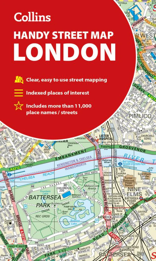
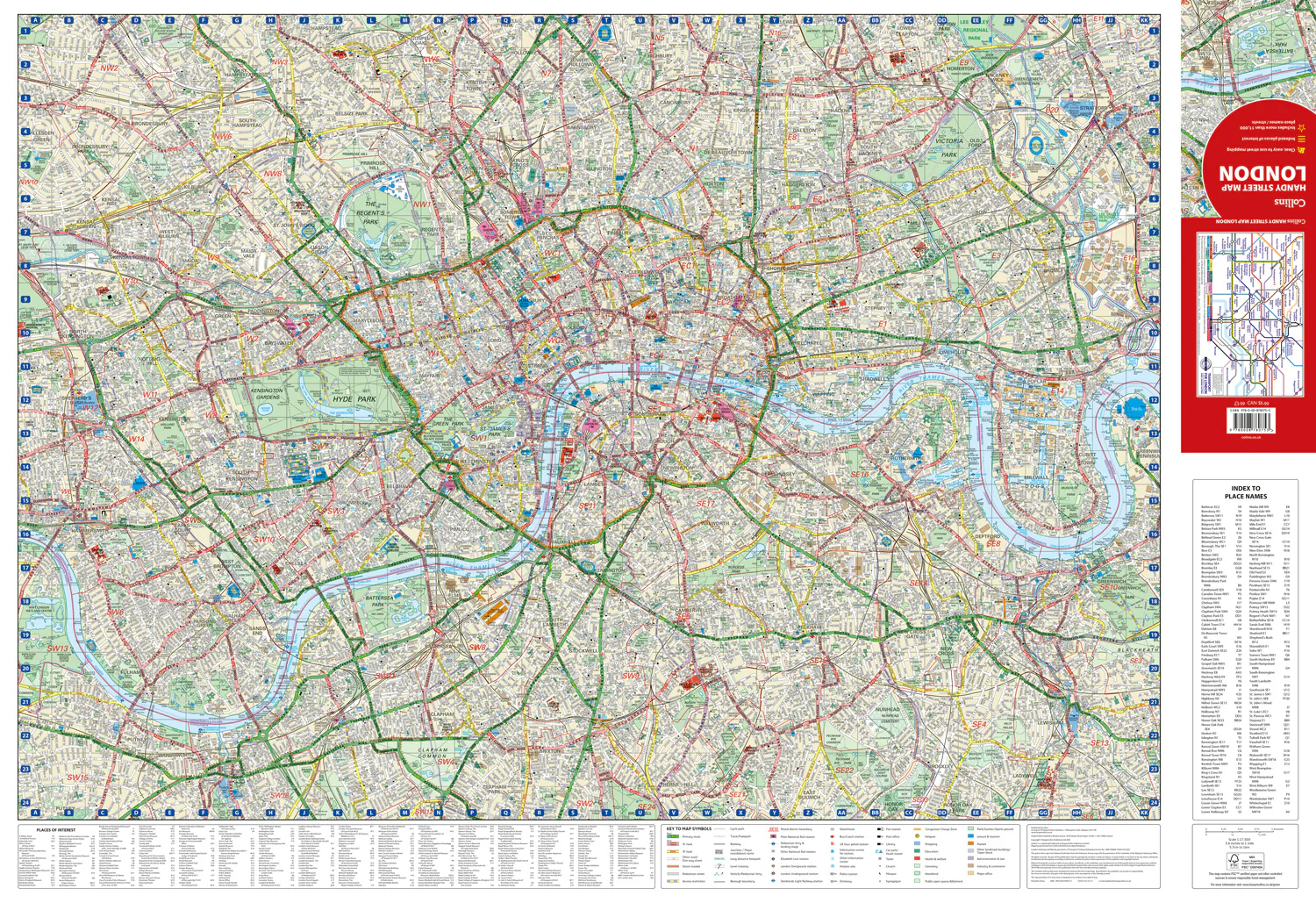
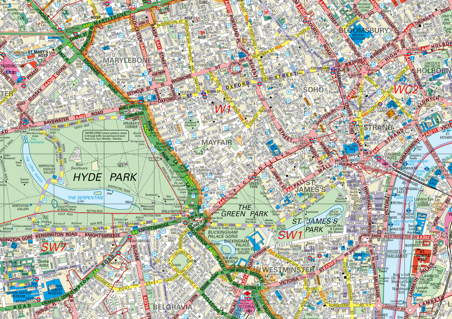
An essential companion for when you are travelling around London.
Clear and easy-to-read map of central London and surrounding area. Contains detailed mapping, presented in a handy compact format.
This attractive map, ideal for both tourists and residents, and fully updated, has an extensive area of coverage and displays a wealth of detail.
This map includes:
• New for this edition: Electric car recharging sites
• Fully classified roads
• Congestion charging zone & T-charge (Ultra Low Emission Zone from April 2019)
• Postal districts and boundaries clearly depicted
• Full indexes to street names (on back of map), place names and places of interest
• Fully updated London underground map conveniently located on the back cover
Covers this area:
Extends from Hampstead in the north to Clapham in the south and from Hammersmith in the west to Greenwich in the east.
Scale: 1:17,500 (3.6 inches to 1 mile)
Details & Craftsmanship
Every detail has been carefully considered to bring you the perfect product.

Details & Craftsmanship
Every detail has been carefully considered to bring you the perfect product.
Details & Craftsmanship
Every detail has been carefully considered to bring you the perfect product.

Details & Craftsmanship
Every detail has been carefully considered to bring you the perfect product.
Description
An essential companion for when you are travelling around London.
Clear and easy-to-read map of central London and surrounding area. Contains detailed mapping, presented in a handy compact format.
This attractive map, ideal for both tourists and residents, and fully updated, has an extensive area of coverage and displays a wealth of detail.
This map includes:
• New for this edition: Electric car recharging sites
• Fully classified roads
• Congestion charging zone & T-charge (Ultra Low Emission Zone from April 2019)
• Postal districts and boundaries clearly depicted
• Full indexes to street names (on back of map), place names and places of interest
• Fully updated London underground map conveniently located on the back cover
Covers this area:
Extends from Hampstead in the north to Clapham in the south and from Hammersmith in the west to Greenwich in the east.
Scale: 1:17,500 (3.6 inches to 1 mile)